What Your Map Isn't Telling You: The Hidden Language of Paper, Ink, and Omission
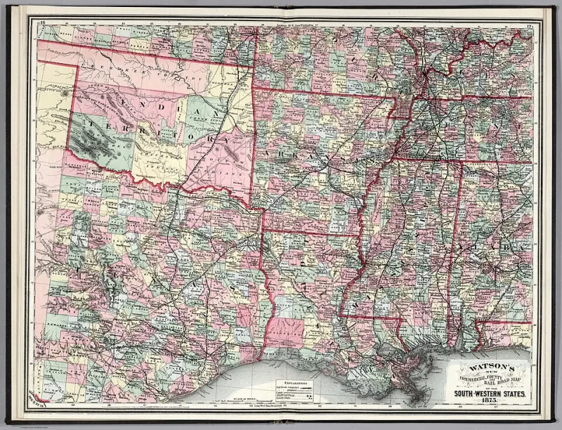
Photo: Watson, Gaylord, Public domain, via Wikimedia Commons
Pull up Google Maps right now and search for a small town — say, Marfa, Texas, or Ely, Minnesota. You'll get a clean grid of roads, a cluster of pins from chain restaurants, maybe a few highly-rated attractions with 4.7 stars. It looks complete. Authoritative. Like the whole truth.
It isn't.
Every map — digital or paper, ancient or fresh off the printer — is a series of editorial decisions. Someone decided what to include. Someone else decided what to leave out. And in that gap between the shown and the hidden, some of the most extraordinary travel experiences on earth are quietly waiting.
The Map Is Never the Territory
Cartographers have a phrase borrowed from philosopher Alfred Korzybski: the map is not the territory. It sounds obvious, but most of us forget it the moment we open a navigation app. We start treating the representation as reality.
Paula Scher, the legendary graphic designer who created some of the most recognized maps in American design history, once described maps as "the most political objects in everyday life." Every projection distorts. Every label is a choice. And every omission is, in its own way, a statement.
For travelers, this matters enormously. Digital platforms like Google Maps are optimized for efficiency and advertiser relationships — not discovery. A mom-and-pop diner that's been feeding loggers in northern Wisconsin since 1954 may not appear because the owner never set up a Google Business profile. A swimming hole outside of Asheville that locals have used for generations won't show up because no one monetized it. A gravel road through the Ozarks that connects two towns in a way that no highway does simply doesn't register as worthy of inclusion.
These absences aren't accidents. They're architecture.
What Vintage Maps Actually Show You
Spend an afternoon at an estate sale or a used bookstore, and you'll often find old gas station road atlases — the kind Rand McNally printed by the millions from the 1950s through the 1980s. Most people flip past them. Serious travelers stop and study.
Old atlases reveal infrastructure that no longer exists: rail lines, ferry crossings, logging roads, resort towns that boomed and faded. But more importantly, they show density of detail that modern maps have stripped away. Small communities that have since been absorbed into sprawl still appear as distinct places with their own identities. Secondary roads that Google now treats as inconveniences are drawn with the same weight as interstates.
One useful exercise: overlay an old atlas page with a current digital map of the same region. The places that appear in the old version but have vanished from the new one? Those are your starting points. Some will have genuinely disappeared. Others are still there — just invisible to the algorithm.
Cartographer and educator Daniel Huffman, who writes extensively about mapmaking ethics, has noted that the shift toward data-driven digital mapping has paradoxically made our picture of the world less complete in certain ways. "We only map what we can measure," he's observed. "And a lot of what makes a place worth visiting isn't measurable."
Hand-Drawn Maps and the Genius of Local Knowledge
If you've ever walked into a small-town hardware store and asked for directions, you've probably received something better than any app can generate: a hand-drawn map on the back of a receipt. Turn left at the old grain elevator. Cross the bridge, go past where the Dairy Queen used to be. You'll know the road because it turns to gravel.
These maps are full of what geographers call vernacular geography — the informal, community-specific way people understand and navigate their own landscape. Vernacular maps name things after people, events, and landmarks that only locals recognize. They encode history. They reflect how a place actually functions rather than how it appears on a satellite image.
Some regional tourism boards have started collecting and digitizing hand-drawn maps from locals, and a few independent travel publishers have built entire guides around them. The results tend to be startlingly useful. A hand-drawn map of the Texas Hill Country produced by a local ranching family will include stock tanks, low-water crossings, and fence lines that mark the difference between a passable road and a stuck truck. No algorithm is building that.
When you're planning a trip to somewhere genuinely off the beaten path, seek these out. Check local Facebook groups, community bulletin boards, visitor centers staffed by actual residents. Ask the person at the front desk of the small motel — not the chain — to draw you a map of their favorite places. What you get back will be worth more than a hundred curated listicles.
How to Read a Map Like a Travel Detective
Once you start looking at maps as editorial documents rather than neutral tools, a whole new layer of information opens up. Here's how to start decoding them:
Look for density gaps. On any regional map, find the areas with the fewest roads, the fewest labeled towns, the fewest points of interest. These blank spaces are rarely empty — they're just underrepresented. National Forest land, tribal territories, and private ranch country all tend to appear as voids. They often aren't.
Follow the old routes. US Highway 30, US-66, the Lincoln Highway — these pre-interstate routes passed through the actual hearts of American towns rather than bypassing them. The towns that grew up along these corridors still exist, often largely unchanged, simply because the traffic stopped coming through decades ago.
Notice what the legend includes. A map that marks historic cemeteries, fire lookout towers, and one-room schoolhouses is telling you something about the values of its maker — and pointing you toward a different kind of travel experience than a map that only marks gas stations and fast food exits.
Cross-reference with topographic maps. USGS topo maps are freely available and show terrain in a way that road maps never do. A valley that looks like nothing on a standard map might reveal itself as a dramatic river canyon on a topo. The geography often explains why certain places stayed hidden.
The Map as an Invitation
There's something about a physical map spread across a kitchen table — edges soft from folding, margins filled with someone's penciled notes — that no app has managed to replicate. It invites a different kind of attention. You linger. You notice the town three inches from your destination that you'd never have scrolled to on a phone screen. You start asking why things are where they are.
That curiosity is the whole point. WonderMap exists because the world is far stranger, richer, and more surprising than any algorithm has bothered to show you. The maps that reveal it aren't always the ones in your pocket.
Sometimes the most useful map is the one someone drew by hand on a napkin, handed to a stranger, and said: this is the real way to get there.
Trust that one.